what is the difference between a swamp and a bayou?
A plain-language breakdown of the difference between a swamp and a bayou, with Louisiana examples, definitions from state and federal sources, and a bookable trip for each.
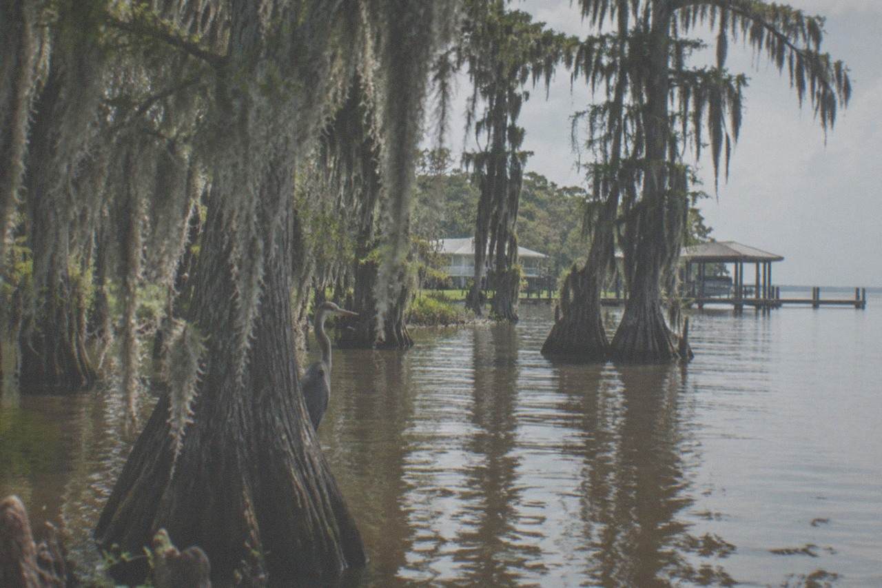
what is the difference between a swamp and a bayou?
A swamp is a wetland defined by its trees, a low, waterlogged area where woody plants such as bald cypress and tupelo grow in flooded soil for most of the year, while a bayou is a slow, sluggish channel of water, often a distributary of a larger river or a creek feeding a lake. In short, a bayou is the waterway and a swamp is the flooded forest that waterway runs through.
The distinction is real, and it comes from hydrology rather than local slang. The United States Geological Survey classifies swamps as wetlands dominated by trees and shrubs, saturated long enough that the soil goes oxygen-poor and only flood-tolerant species survive in them. A bayou, by contrast, is a channel. It has banks, a current you can sometimes see and sometimes not, and a downstream direction, even when the water moves so lazily that the surface looks like glass. Louisiana has both in unusual quantities because the land is flat, young, and constantly rearranged by the Mississippi River.
The words get tangled in everyday speech for a defensible reason: in south Louisiana the two features usually arrive together. A bayou drains a swamp, or a swamp grows in the floodplain beside a bayou, and a boat trip through one will almost certainly pass through the other. When a tour operator says "swamp tour," the boat may spend half its route inside a flooded cypress stand and the other half on an open bayou, and nobody on board is wrong to call the whole thing either name.
That overlap is why the vocabulary question is worth answering properly. Knowing which word applies to which feature tells you what you will actually see on the water, what kind of boat makes sense, and which of the tours around New Orleans matches the landscape you have in your head. If you want the short version of that matching, the New Orleans Swamp Tours homepage lays out all nineteen trips side by side with prices and review counts.
For a first taste of the difference, three trips cover the spread well: a classic covered-boat bayou cruise, a beginner-friendly kayak paddle into a true swamp, and a self-drive boat tour through the cypress of Honey Island.
Which famous Louisiana waters are swamps, and which are bayous?
Around New Orleans the best-known swamps are Honey Island Swamp, the roughly 70,000-acre Pearl River wetland across Lake Pontchartrain; the Manchac and Maurepas swamp complex west of the city; and the flooded forests of the Barataria basin south of Marrero. The best-known bayous are Bayou St. John inside New Orleans itself, Bayou Barataria on the west bank, Bayou Lafourche running down to the coast, and the countless small channels threading through all three swamp systems.
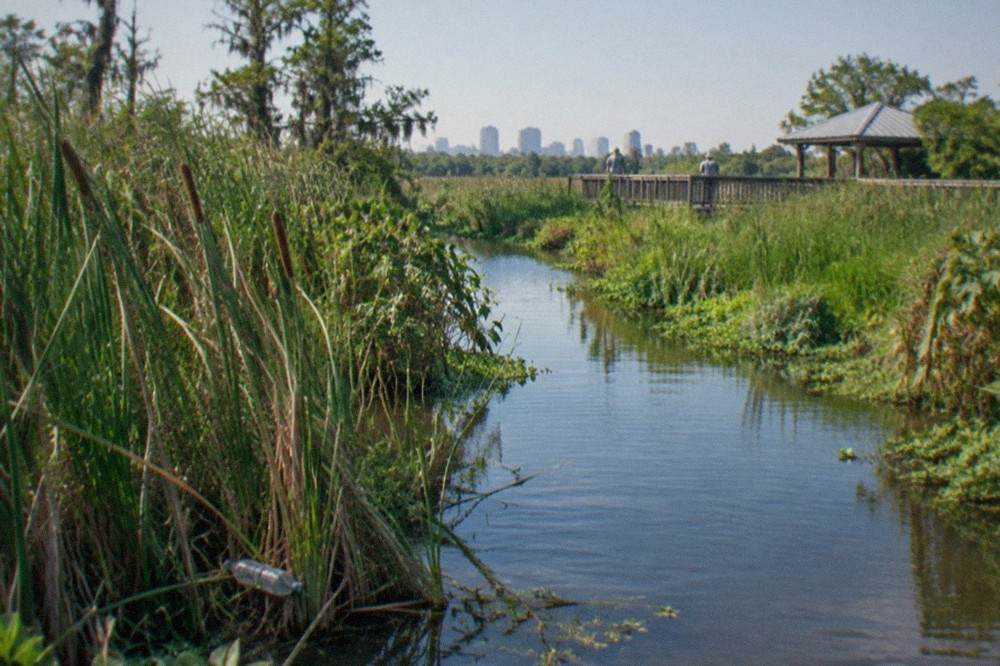
The table below sorts the waters a New Orleans visitor is most likely to hear about. A few of them are genuinely both things at once, and the notes say so.
| Water | Type | Where it sits | What you actually see |
|---|---|---|---|
| Honey Island Swamp | Swamp | Pearl River basin, ~45 min from New Orleans | Flooded bald cypress and tupelo, alligators, herons, one of the least-altered river swamps in the country |
| Manchac / Maurepas Swamp | Swamp | West of the city, along Lake Maurepas | Public wildlife-management-area cypress flats, paddled by small kayak groups |
| Barataria basin swamps | Swamp | South of Marrero, near the national preserve | Wooded wetlands threaded by boat channels, alligators on sunny banks |
| Bayou St. John | Bayou | Inside New Orleans city limits | A slow urban channel, paddled by locals; a large alligator sighting here drew wide attention in 2025 |
| Bayou Barataria | Bayou | West bank, through the town of Jean Lafitte | Working fishing bayou, the route most Barataria swamp tours travel to reach the trees |
| Bayou Lafourche | Bayou | South of the city, toward Thibodaux | A long settlement channel, historically a distributary of the Mississippi |
Two entries deserve a note. Bayou Barataria is the road, in water terms, to the swamps: tour boats head down the bayou and then branch into the flooded woods, so a single trip shows you the channel and the forest in sequence. And the Barataria basin itself is a mix, which is why locals reach for whichever word fits the sentence rather than the map.
The town of Jean Lafitte, at the end of Leo Kerner Lafitte Parkway, has leaned into the pairing deliberately. The Louisiana Wetlands Educational Center there opened in March 2026 and now doubles as the temporary visitor hub for the national preserve while its own trails are rebuilt, with a boardwalk trail, exhibits on coastal land loss, and a museum on the town's pirate-historied namesake. It is a good stop before or after a Barataria boat trip, and the rangers run guided walks on the Wetland Trace trail.
Why do the trees decide whether it is a swamp?
A swamp is classified by its vegetation, not its water depth. Bald cypress and water tupelo are the signature species because they can survive with their roots in oxygen-starved, permanently soaked soil, where almost every other Louisiana tree would rot. Standing woody trees growing out of still water for most of the year make a swamp. Open water moving between banks makes a bayou, even when cypress leans over those banks from dry ground.
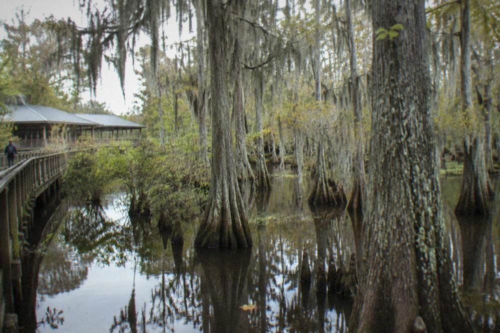
The cypress is the giveaway plant, and it is a strange one. It is a conifer that drops its needles in winter, grows the knobby "knees" that poke above the waterline around its trunk, and can live for centuries. The swamps around New Orleans hold some of the finest surviving stands, precisely because the water that makes the trees possible also made the land hard to farm and drain. Honey Island Swamp, part of the Pearl River basin, is regularly described as one of the least-altered river swamps in the United States, with no pipelines or oil platforms inside it, and roughly half of its 70,000 acres under protection.
The wildlife follows the trees. Alligators bask at the waterline because the flooded forest gives them cover and food; herons, egrets, ibis, and bald eagles nest and hunt where the canopy holds; black bears and wild hogs move through the higher ground of the surrounding basin. A bayou supports its own wildlife, fish, turtles, nutria, and the alligators that patrol the channel, but the crowded, moss-hung forest is what people picture when they say "swamp," and the picture is accurate.
That difference in scenery is a real decision point for a visitor, not just vocabulary. If you want the moss-draped, close-in, tunnel-of-trees experience, book a trip into a true swamp such as Honey Island or Manchac. If you want open water, wider sightlines, and a boat that can move, a bayou-based trip such as the Barataria cruise fits better. The Honey Island swamp tour guide covers the cypress side in detail.
Where does a bayou begin, and where does it end?
A bayou usually begins where a larger river or lake sheds water into a slow side channel, and it ends where that channel reaches another lake, the sea, or simply fades into the marsh. Bayou Lafourche, for example, was once an active distributary of the Mississippi, carrying river water toward the Gulf. The defining behavior is sluggish flow: a bayou moves, but so slowly that in dry stretches the direction is hard to read.
The word itself is Louisiana's own. It entered American English through Louisiana French, and it describes a landform the Mississippi delta produces almost nowhere else in the world: a channel wandering across ground so flat that water would rather spread than run. Where an upland creek carves a valley, a bayou meanders through a landscape barely above sea level, changing course over decades, silting up in one stretch while cutting a new loop in another.
Bayous also change with the weather in ways that matter to tour planning. The Pearl River area around Honey Island saw flood closures in the late spring of 2026, when high water covered access roads to the adjacent wildlife management area, and the river gauge at the town of Pearl River is the official trigger for one local road closure at 16.5 feet. By late September the same gauges read roughly three to five feet, and tours were running daily. Bayou water levels are seasonal facts, not trivia: they decide which side channels a boat can enter and how much of the swamp is actually flooded.
The urban example is worth knowing because it is inside the city. Bayou St. John is a short, slow channel connecting City Park to Lake Pontchartrain's edge, paddled by residents year-round, and it made local news in 2025 when a large alligator sighting there went viral. A visitor can stand on its banks without leaving New Orleans, which makes it the cheapest possible illustration of the bayou half of this article's vocabulary lesson.
Can you see both a swamp and a bayou on one trip?
Yes, and most New Orleans tours do exactly that without advertising it. A Barataria boat tour travels down a bayou to reach the swamp, then returns along the same channel, so a single 90-minute ride covers both definitions. A kayak trip into Manchac paddles a bayou-side launch and then enters the flooded forest itself. The practical choice is not swamp versus bayou but which one you want to spend the most time inside.
The Barataria trip is the cleanest example. Adventures of Jean Lafitte runs its swamp boat from Marrero into waterways adjacent to the Barataria Preserve, and the route is a bayou-and-forest sequence: open channel first, then the wooded wetlands where the alligators gather. The bayou wildlife tour is from $30, holds 4.5 across 1,615 reviews, and offers a pickup option, which makes it one of the cheaper guided ways out of the city. The bayou trip compared with the preserve is a question worth reading before you book, since the national park's own trails are in a construction phase.
The kayak alternative spends its time on the swamp side of the line. Zip NOLA runs a beginner-friendly guided paddle on Lake Maurepas, from $49 for an hour and a quarter on the water, with no rating printed on the listing, so judge it on its format rather than a review pool. The Maurepas Swamp wildlife management area is one of the two permitted commercial kayak areas in the region, and the paddle puts you inside the flooded forest rather than looking into it from a boat rail.
One planning note on the swamp side: the best time for a swamp tour matters more than the swamp-versus-bayou choice. Alligators are cold-blooded and hard to find when the water is much below 70 degrees, so the same forest can feel packed with wildlife in April and empty of it in January, regardless of which boat or paddle you choose.
How are Louisiana's swamps and bayous changing?
Both are in active, engineered transition. A $300 million project is reconnecting the Mississippi River to the Maurepas Swamp through Hope Canal, aiming to deliver up to 2,000 cubic feet per second of freshwater to roughly 45,000 acres of starving cypress, with completion expected in 2030. In the Barataria basin, the Upper Barataria marsh creation project built 1,170 acres of new wetland, and NOAA reported shrimp and crab returning to it within a year.
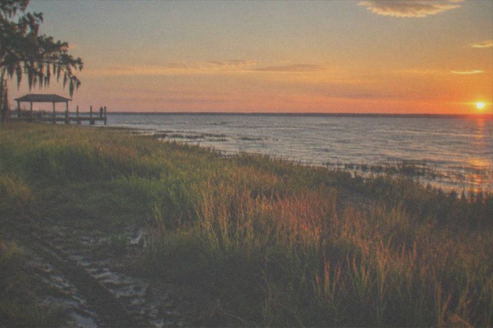
The Maurepas project is the one a visitor is most likely to notice, because the swamp it is rescuing is the one kayakers paddle. Decades of levees cut the swamp off from the river sediment and freshwater that kept its trees alive; the reintroduction now under construction near Hope Canal is designed to reverse that, and the Coastal Protection and Restoration Authority tracks the work on its river reintroduction project page. The state wildlife agency, which manages the swamp as a wildlife management area and licenses its commercial kayak operators, covers the same ground at its Maurepas Swamp page.
The Barataria side has its own changes, and one of them affects tourists directly. The Barataria Preserve of Jean Lafitte National Historical Park closed its visitor center and most trails in February 2026 for a two-year repair and boardwalk-rebuilding program, following Hurricane Ida damage; the National Park Service posts current status on its alerts and conditions page. Commercial swamp tours in the basin are unaffected, since they run on waterways beside the preserve, but anyone planning a hike-and-boat day should check the trail status first.
The vocabulary from the top of this article explains why the engineering matters. A bayou is a conveyor: it moves water, sediment, and nutrients from one place to another. A swamp is a filter and a nursery: it holds that water long enough for the trees to use it. Cut the conveyor and the filter clogs with saltwater and dies; reconnect it and the forest gets another century. Louisiana is spending hundreds of millions of dollars to keep the two words describing real, living places rather than historical ones.
Which trip should you book for each word?
Book the Barataria wildlife cruise from $30 for the bayou, a 4.5-rated trip across 1,615 reviews that runs on open channel water, and book the Honey Island self-drive boat tour from Cajun Encounters, from $38 with a 4.9 across 232 reviews; Dr. Wagner's similar tour starts at $37.75, for the swamp, since it puts you inside the cypress forest fed by the Pearl River. Doing both over two days is easy because the launch points sit on opposite sides of Lake Pontchartrain.
The Honey Island option deserves its solo mention because it is the purest swamp trip on the roster. You drive yourself to the Slidell launch at 55345 US-90, the same dock Dr. Wagner's has used since partnering with Cajun Encounters, and the roughly two-hour ride goes straight into flooded cypress and tupelo. The self-drive price of $38 is the cheapest way onto that water; the transport-included version costs more but removes the drive. If the folklore angle appeals, the Honey Island Swamp Monster story is the local legend, and the swamp it lives in is the one on this tour.
If you would rather not choose a side at all, the trio below covers the full vocabulary in three different vehicles: a covered boat on the bayou, a kayak in the swamp, and a pontoon through the Pearl River forest. Prices and review counts sit on each listing, and every trip links to its operator's live page.
Common Questions About Swamps and Bayous
what is the difference between a swamp and a bayou?
A swamp is a flooded forest, defined by the trees that grow in permanently saturated soil, chiefly bald cypress and water tupelo. A bayou is a slow-moving channel of water draining through flat ground, often a distributary of a larger river. A bayou frequently runs through or beside a swamp, so the two features usually appear together.
Is Bayou St. John a swamp?
No. Bayou St. John is a true bayou: a short, slow channel inside New Orleans city limits connecting City Park toward Lake Pontchartrain. It has banks, open water, and a direction of flow, not a flooded forest, though trees line its edges.
Do alligators live in both swamps and bayous?
Yes. Alligators patrol bayou channels and bask along swamp banks alike. Louisiana's wild population exceeds 3 million animals. Sightings are more reliable in warm weather, since alligators become slow and hard to spot when the water drops well below 70 degrees.
Why does Louisiana have so many bayous?
Because the land is extraordinarily flat and young. The Mississippi delta is built from deposited sediment barely above sea level, so instead of carving valleys, water spreads and meanders into slow side channels. The word "bayou" itself entered American English through Louisiana French.
Can a bayou turn into a swamp?
Over time, yes. A slow bayou drops its sediment, grows vegetation along its margins, and can choke into marsh or flooded forest. The reverse happens too, when floodwater or engineering reopens a channel through wooded wetland. The two landforms trade places on a scale of decades.